This guide will explain how to create a GIS Shapefile or geoJSON of your project's exported comments.
Comments that have been dragged and dropped onto the map by users will automatically be tagged with their Latitude and Longitude coordinates.
http://www.qgistutorials.com/en/docs/importing_spreadsheets_csv.html
To export your Project(s) Data:
-
Log in to your Social Pinpoint Admin site
-
In the main title bar click the Comments option
-
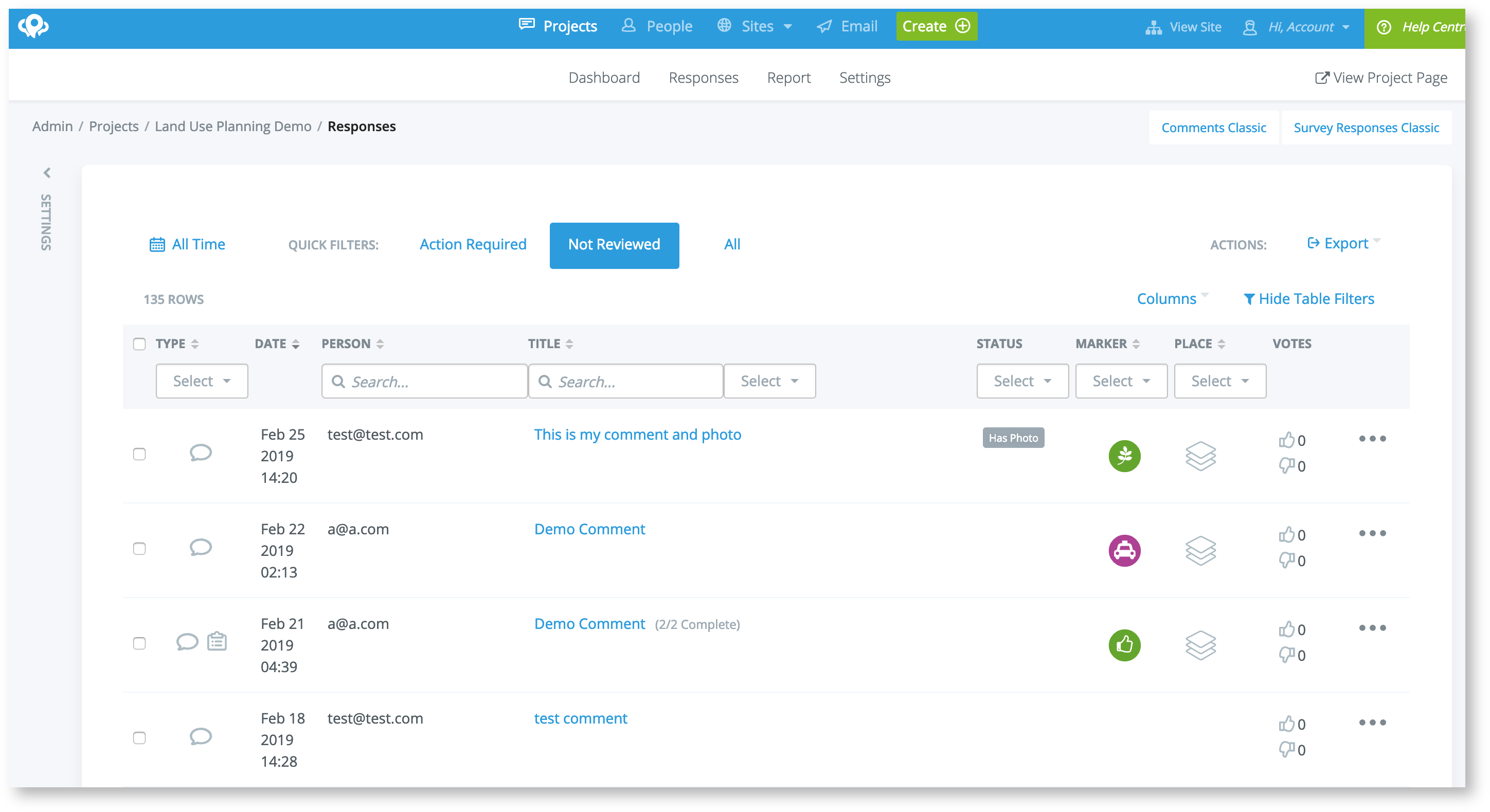
On the Comments page, select the 'Export CSV' option on top right of the page
Log in to your Social Pinpoint Admin site
In the main title bar click the Comments option
On the Comments page, select the 'Export CSV' option on top right of the page
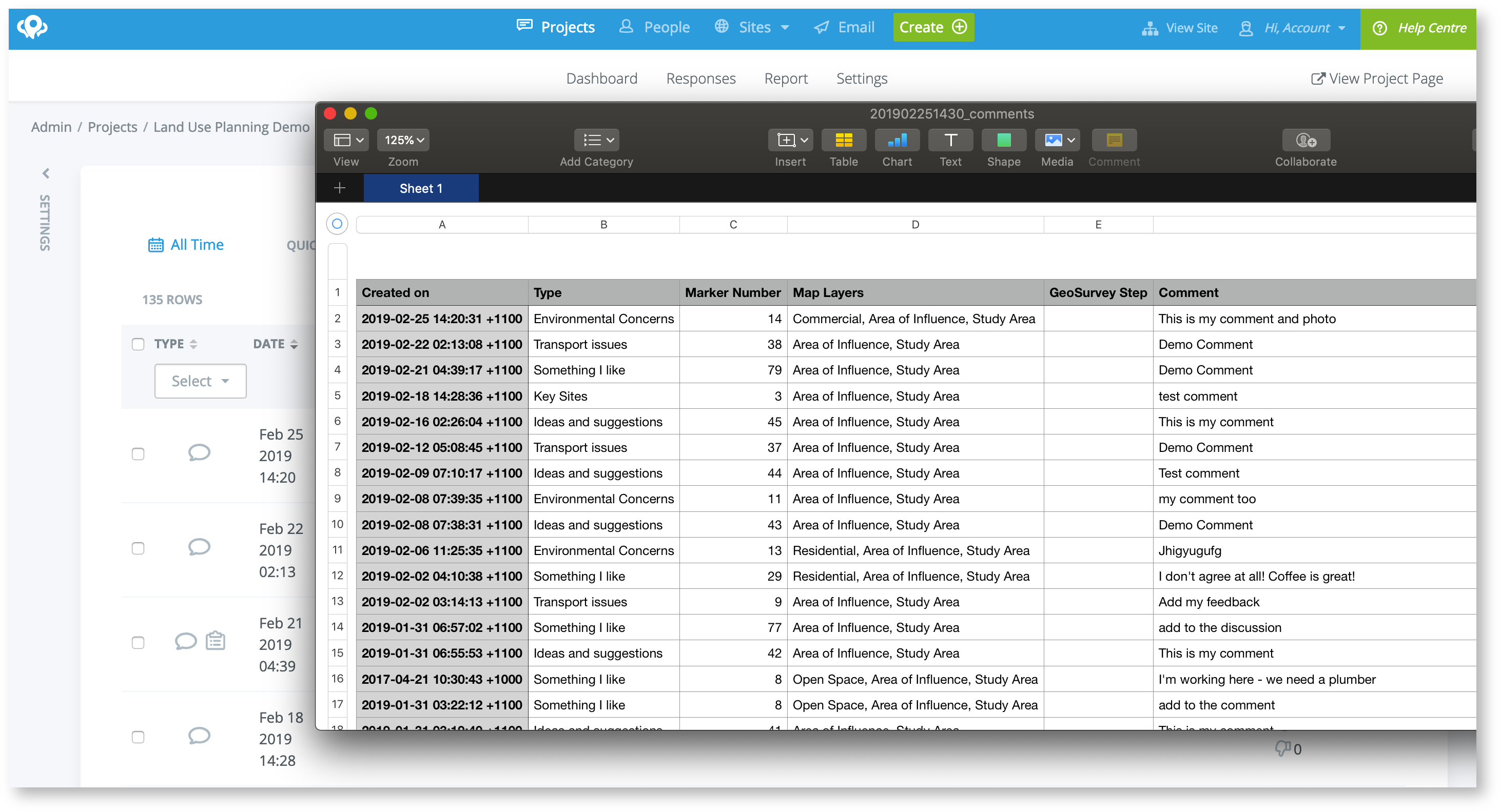
The resulting csv file can be opened in Excel for further analysis and reporting.
You can also use the CSV to create GIS files such as Shapefiles or geoJSON.
Note: the excel file will already have columns which contain the Latitude and Longitude of each comment.
Open a new project in your GIS software (we use QGIS which is free)
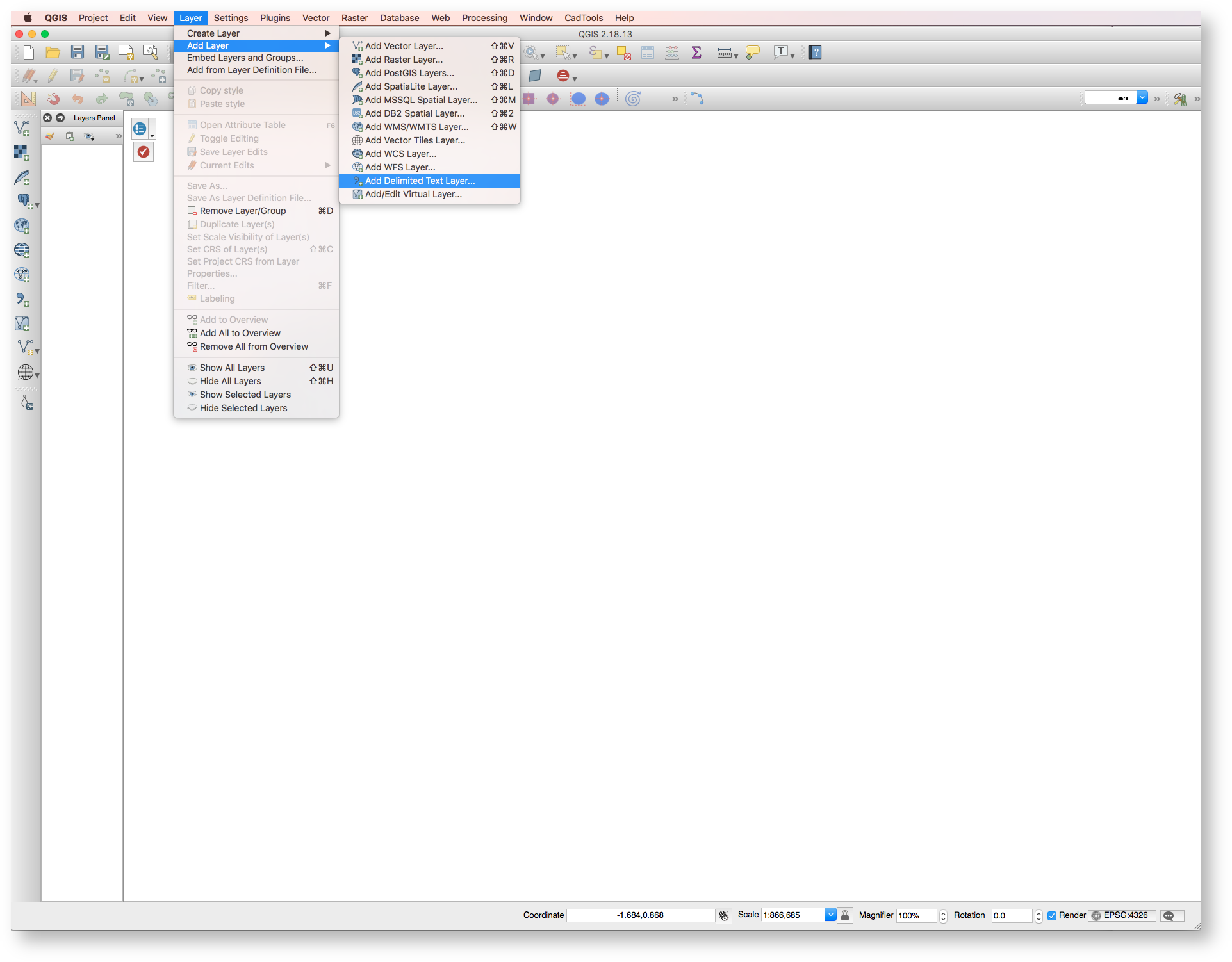
Go to Layer > Add Layer > Add Delimited Text Layer
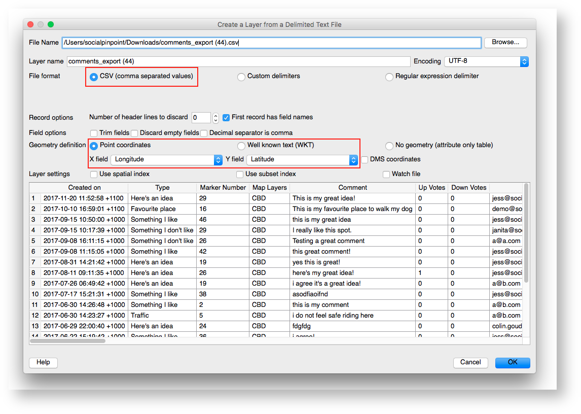
Click on Browse and specify which CSV file you would like to convert from your computer (note: it might be in your Downloads folder).
In the File format section, select CSV (comma separated values).
The Geometry definition section will be auto-populated with the Longitude and Latitude tabs in the CSV.
Click OK.
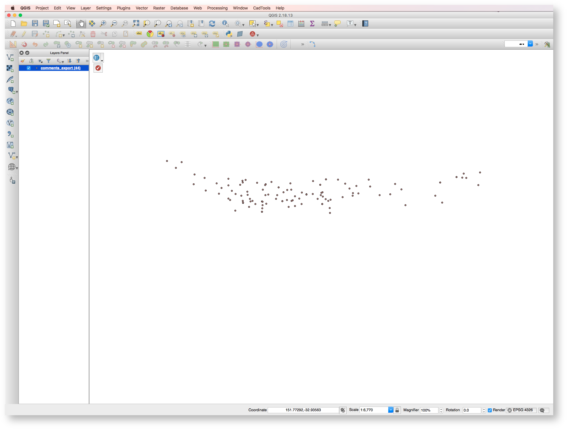
All of the points should now be added as a layer in the GIS file.
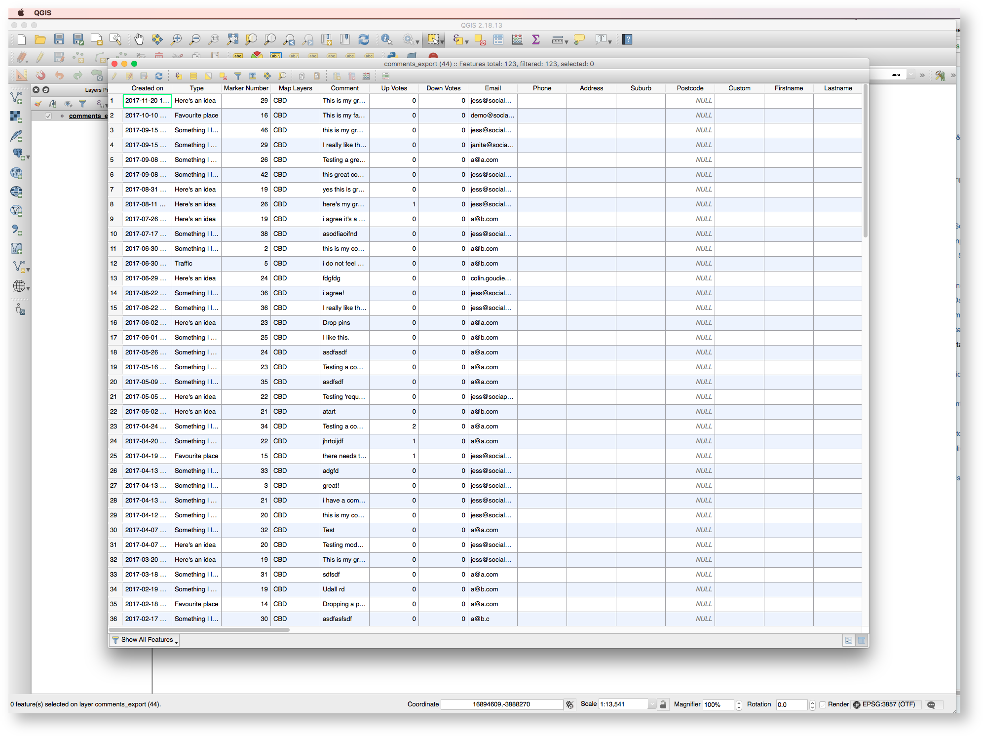
Open the Attributes table and notice that all of the information related to the comments including survey responses have been added as attributes.
You can use these attributes to perform functions for data analysis.
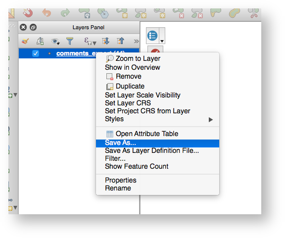
To Save, right click on the Layer in the Layers Panel and click Save As
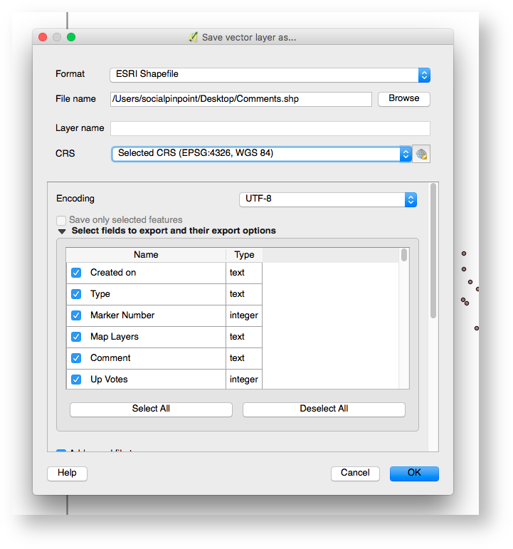
Choose which format you would like to save the file as - for this example we chose ESRI Shapefile, but you can also save the file in a number of other formats (depending on the options in your GIS software).
Choose the Coordinate Reference System (CRS) that is appropriate for the accuracy of the location of the points.
For use in Social Pinpoint we require that the CRS is EPSG:4326, WGS 84).
Click OK.
