There are many different formats of GIS data can be created. To be compatible with Social Pinpoint GIS data is required to be EPSG:4326 (WGS84). This FAQ will guide you through converting GIS files using QGIS (an open source GIS application).
Step-by-step guide
Open QGIS
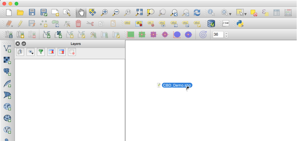
Drag your .SHP file from explorer/finder into QGIS

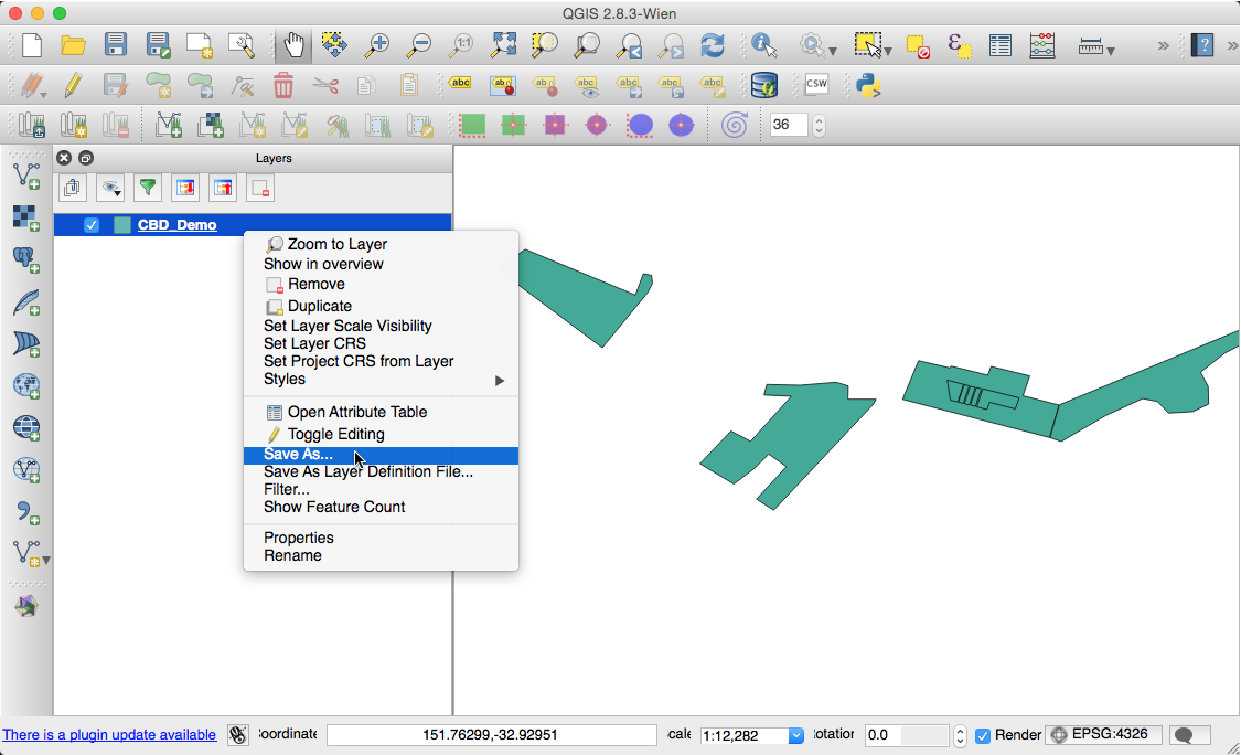
Right-click on the layer and select 'Save As'

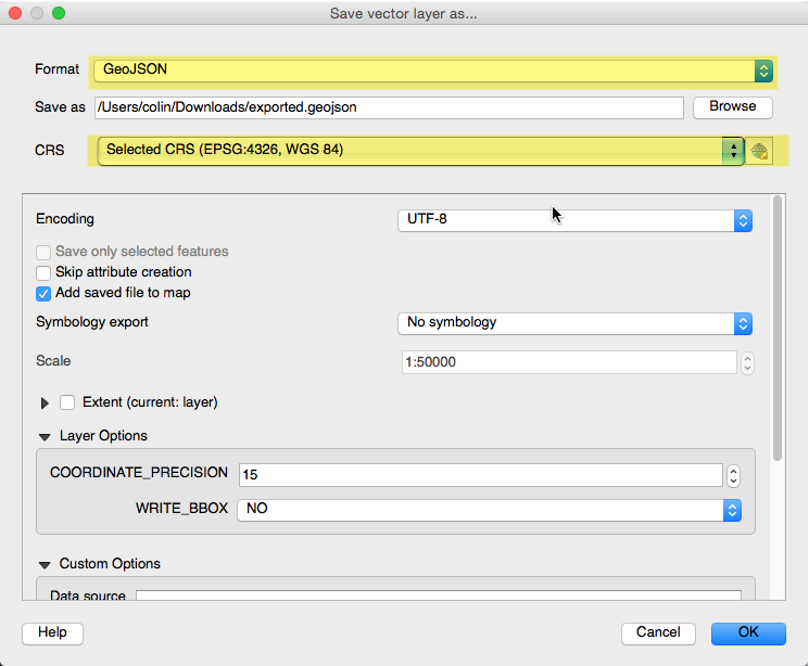
Ensure the format is GeoJSON or ESRI Shape File and the CRS is EPSG:4326, WGS 84.

ℹ️ You can now upload your converted data into Social Pinpoint
