Map Layers - Polygons
How to add a polygon layer and use-cases for that layer type
Step-by-step guide
Polygon layers are great for creating a boundary or study area within your project. Polygons can also be made interactive and can contain information, images, videos or surveys when clicked on.
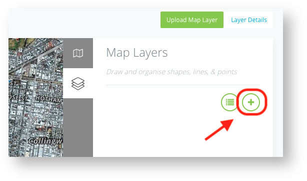
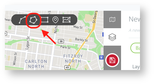
To draw a polygon layer, select the plus + to create a new layer and select polygon from the options at the top of the map.


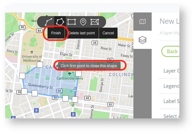
Draw your polygon by selecting different points on the map. Once happy, select Finish or your first point on the shape.

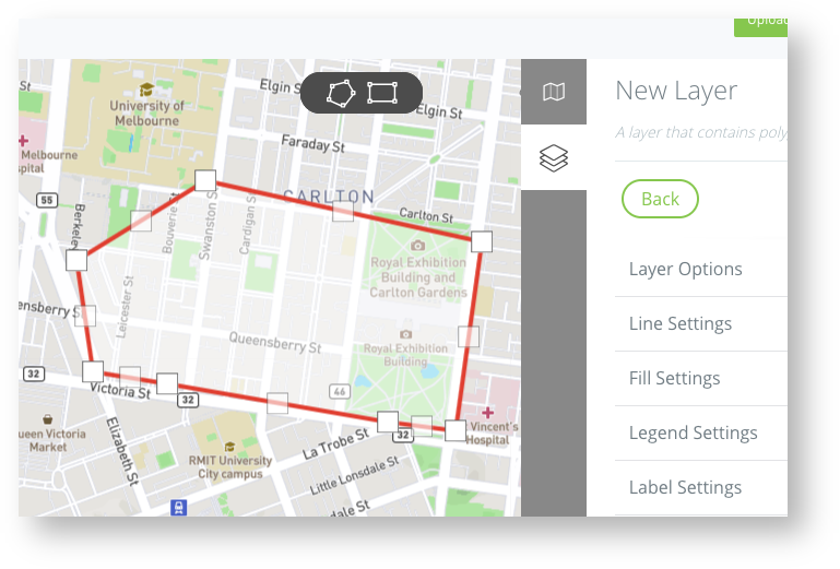
You can now style and edit the line to look and act however you like using the layer setting on the right.
